Ebey’s Landing National Historical Reserve: A Story of Ice and Fire
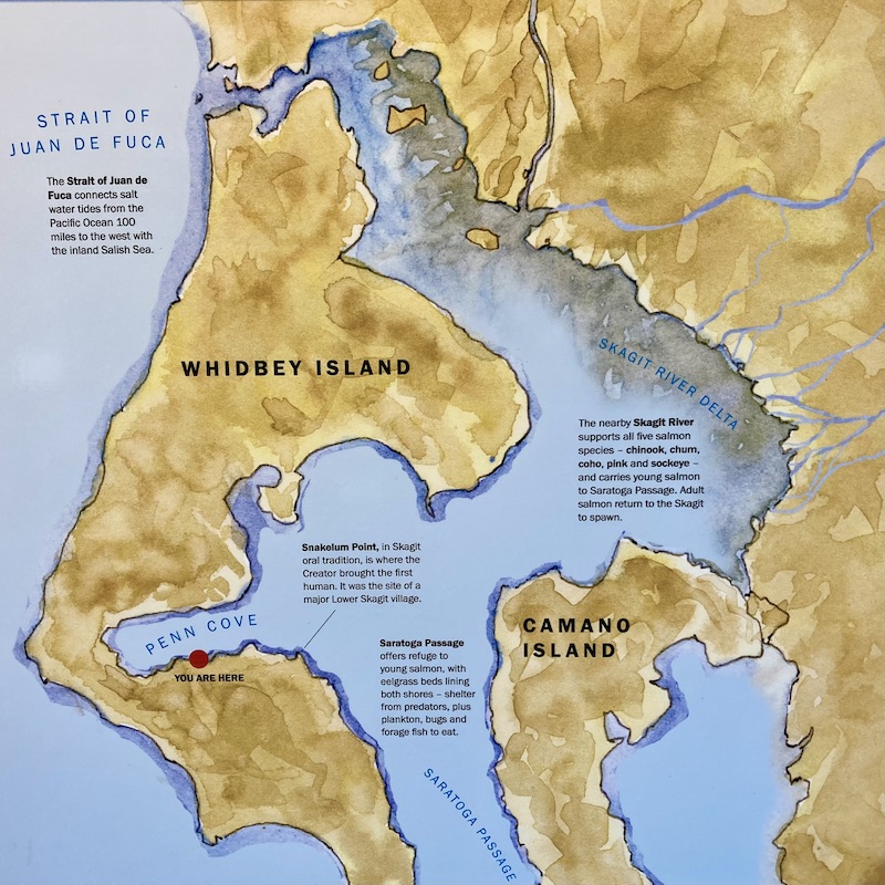
“Ebey’s Landing National Historical Reserve (EBLA) consists of 17,400 acres of prairies, forest, and seashore on Whidbey Island. The Reserve sits at a geographical nexus in northern Puget Sound, where the north-south alignment of the Puget Trough meets the eastern end of the Strait of Juan de Fuca. The commanding position of this place, coupled with its rich marine life, and its deep glacial soils and meadows borne of anthropogenic fires within the Olympic Peninsula rain shadow, have contributed to the enduring use of this landscape by human populations through time. The cultural resources documented within the Reserve attest to this long human history, spanning documented archeological sites from the late Paleolithic to the rural 19th century farmsteads that arose after Euro-Americans resettled the lands of Puget Sound.”
— Douglas Deur, An Ethnohistory of Traditionally Associated Contemporary Populations (2009)
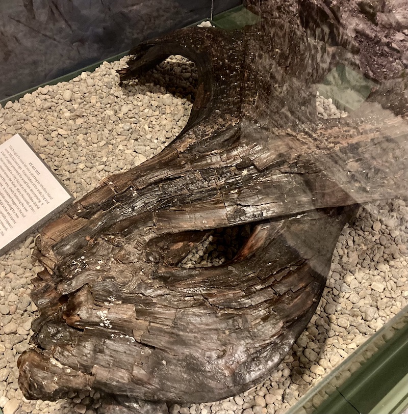
You might have thought that the oldest artifacts on display at the Island County Historical Society Museum are its collection of mastodon molars. There is one item on exhibit, however, that has these massive teeth beat by some one hundred millennia…and the story of its preservation is material evidence of the geological forces that created Whidbey and Camano islands.
The story goes like this.
Some 100,000 years ago, a Douglas fir trunk fell into a peat bog on Whidbey Island. Its encapsulation in the acidic bog and a lack of oxygen prevented the wood from decomposing. It was then entombed in a clay deposit as the Whidbey Glacial Ice Sheet plowed across the island, resulting in thousands of tons of glacial ice covering the area and slowly flattening the tree under its incredible weight. It remained trapped in the soil until 1993, when a massive landslide containing the tree came down, settling on a tide flat. Tidal action and storms eroded the side debris until 2001, when a partially exposed section of the tree trunk was spotted and recovered for research and preservation. At an estimated 120,000 years, it is the oldest item in the museum’s collection.

A Story of Ice
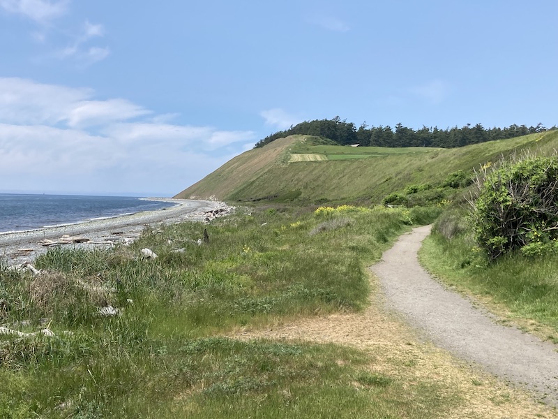
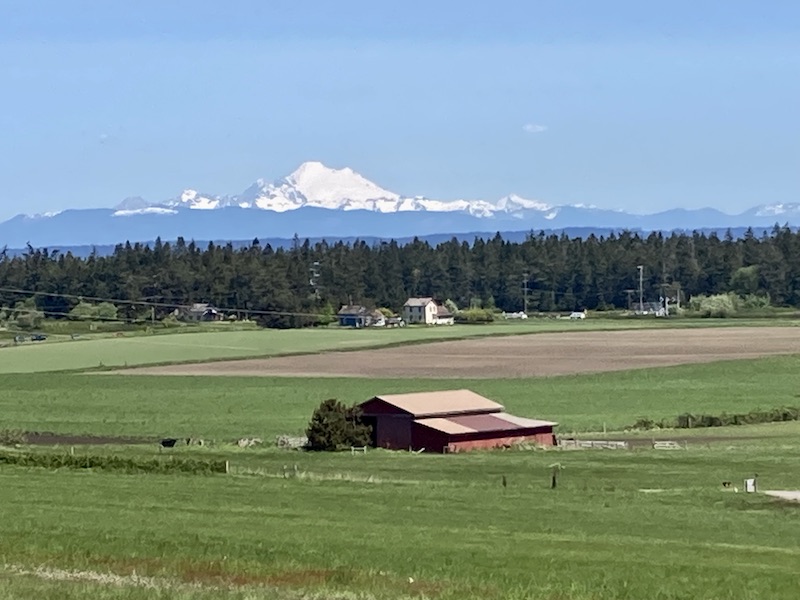
Standing at the Ebey Prairie overlook on Sunnyside Cemetery, you have a breathtaking view. To the south is a vista of fertile prairie land with its patchwork of farms. Mount Baker looms to the northeast, with more snow covered peaks in the distance as your gaze continues eastward. To the west are the waters of the Admiralty Inlet with the Olympic Peninsula and its mountains — also snow covered — on its other side. If you’ve seen the Ebey’s Landing National Historical Reserve, there’s simply no forgetting it. Which makes it hard to imagine that at this site some seventeen thousand years ago you would, like the Douglas fir trunk, have been standing under a sheet of ice some five times the height of Seattle’s Space Needle.
Roughly 17,000 years ago, along the west coast of North America, the last continental glaciation extended southward from British Columbia into the Puget Sound lowland. Ice covered this region for about 1,000 years and then began to melt and retreat. The Vashon Glacier, the final gasp of the last ice age, covered all of present day British Columbia and stretched over 50 miles south of Seattle.
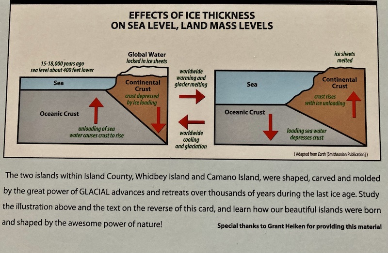
The glaciers near Coupeville were 1,200 meters (3,900 feet) thick; their weight of about 576 billion tons depressed the land — because the Earth’s crust is flexible, it responds to overlying masses such as glaciers. At the same time, glacier growth caused the global sea level to drop because so much of its water was locked up in ice. The combination of lowered sea level and depressed land resulted in the Coupeville area being about 150 meters (500 feet) below what is today’s sea level. When the last glaciers began retreating, sea level was about the same as today’s Sunnyside Cemetery on the ridge above Ebey’s Prairie, and the sea floor itself was at the level of the prairie.
A Story of “Anthropogenic” Fire
With a warming climate, the glaciers’ terminuses began to recede to the north. As glaciers melted, the land surface rose (a process known as isostatic rebound, for all you science buffs) and sea level rose simultaneously. Here the rate of rising land exceeded that of the rising sea, thus creating Whidbey Island. As the island slowly rose, ocean waves on Admiralty Inlet and the Saratoga Passage cut terraces into its slopes. These wave-cut terraces are visible at several elevations; the most obvious terrace is in Clinton, where the steep highway levels out above the ferry dock.
As the climate warmed and the glacier retreated it scoured, scraped, and blasted this landscape into existence. The grinding and plowing action of the glaciers helped add organic matter to the rocky substrata, ultimately creating the rich soils that provide a fertile habitat for a large array of flora, and that benefits farmers and gardeners to this day. And as the glaciers retreated, life took hold on these islands with coniferous forests, tundra and sagebrush plains – home to Columbian mammoths, horse, bison, mastodon, and caribou. The open prairies like those we see in Coupeville were first formed when melting glacial runoff pooled in temporary lakes and deposited as much as 50 feet of drift and till, laying the foundation for the rich farmland and steep bluffs you see here today.
But Ice alone was not powerful enough to keep the prairies open. For over 3,000 years, American Indian settlers burned this land to keep the forests at bay and harvest the plants that grew there, such as the essential camas roots. Environmental change originating in human activity such as this is referred to as “anthropogenic.”
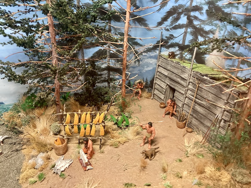
Since time immemorial Coast Salish have enjoyed the abundance of Penn Cove including salmon (which fossil records show to have been present a million years ago) and bottom fish, shellfish, berries, deer and waterfowl, and materials for other uses. Native peoples gathered resources for year-round provisions and skillfully created tools of bone, stone, shell and wood. Artifacts show they were present 10 -13,000 years ago; their descendants still live in this region today. The Lower Skagit tribe lived in villages around Penn Cove. They held generous potlatch celebrations hosting relatives and friends from surrounding communities.
A Bold New Idea
In 1968, a seemingly simple zoning request kicked off a fight over the future of Central Whidbey Island.
When proposed development threatened to cut off access to a beloved beach and replace the heritage farmland we see today with subdivided residential lots, some local residents recognized that a way of life was about to be lost. Community, historical, and environmental groups began to mobilize, and together they started a conversation that would last decades and test the bonds of friendship.
Years of litigation, contentious council meetings, and exhausting public discussions followed until eventually a new model of preservation emerged with the creation of Ebey’s Landing National Historical Reserve. The Reserve would depend on the participation of the local population and government partnerships to preserve this rural farming community. Today, when you stand at the Ebey’s Prairie overlook, you are standing in the middle of the nation’s first National Historical Reserve, an experiment that began in 1978 and proved that a community can choose to preserve itself — a fact that the First Peoples of this place continue to demonstrate through events such as the Penn Cover Water Festival and their reclaiming of their language and cultural heritage.