The Journey of The Corps of Discovery in 462 Words
Over the next couple of years (give or take a few months), my goal with Meyer Sign’s “Core of Discovery” series is to visit and write about every site associated with Lewis & Clark and the nearly 40 individuals (not including Meriwether Lewis’ faithful Newfoundland, Seaman) who accompanied them on their more than 4,000 mile journey across eleven states from St. Louis, Missouri to the Pacific Ocean, as designated by the National Park Service/U.S. Department.
As a prelude to this epic journey, which I’m fond of referring to as “The Great American Odyssey,” I’d like to share this excellent summary from a brochure published by the National Park Service as an introduction to the sites associated with the Corps of Discovery’s arrival at the mouth of the Columbia River — starting appropriately enough with Captain William Clark’s six-word journal entry on November 7, 1805:
“Ocien in view! O! The joy.”
When Capt. William Clark wrote these words in his journal on November 7, 1805, he was not standing at the Pacific Ocean but the Columbia River estuary. It would be another couple of weeks before he or Capt. Meriwether Lewis would stand at what they had “been so long anxious to See.” By then they had traveled over 4,000 miles across the North American continent with a contingent of 31 explorers, mostly U.S. Army enlisted men, known as the Corps of Discovery.
The expedition was President Thomas Jefferson’s idea. He had for years been fascinated by the vast and virtually unknown territory west of the Mississippi River. In June 1803 he announced plans to send an exploratory party by rivers to the Pacific. He chose Lewis to head it, and Lewis selected Clark, his friend and former commanding officer, to share the responsibilities. They were to explore the Missouri River to its source, then establish the most direct water route to the Pacific, making scientific and geographic observations along the way. They were also to learn what they could of Indian tribes they encountered and impress them with the technology and authority of the United States.
The explorers started up the Missouri River from near St. Louis on May 14, 1804. After a tedious journey of five months, they wintered at Fort Mandan, which they built near the Mandan villages 1,600 miles up the Missouri. Here they acquired the interpreting services of Toussaint Charbonneau, a French-Canadian trader, and his young Shoshone wife, Sacagawea, accompanied by their infant son, Jean Baptiste.
In April 1805 the Corps of Discovery left Fort Mandan and followed the Missouri and its upper branches into an unmapped world. Along the Lemhi River, in what is now Idaho, Sacagawea’s people provided horses and a guide for the grueling trip over the Continental Divide. In mid-November 1805, after some 600 miles of water travel down the Clearwater, Snake, and Columbia rivers, the Corps of Discovery finally saw the Pacific Ocean after setting up temporary camp (Station Camp) on a sandy beach on the north shore of the Columbia.
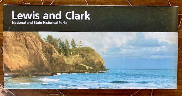
For 10 days the men explored the surrounding area, including Cape Disappointment, looking for a favorable site for a winter encampment. Finally, on November 24, expedition members voted to cross to the south side of the Columbia, where game was reported to be plentiful. Lewis and a small party found a “most eligable” site about two miles up the Netul River (now Lewis and Clark River). On December 10, 1805, the men began to build a fort that they named for the local tribe, the Clatsop. By Christmas Day they were under shelter. It would be their home for the next three months.
Footnote: the first sentence in this description states that Capt. Clark was not actually in sight of the Pacific Ocean when he made is November 7, 1805 journal entry. This piece of conventional historic wisdom has more recently been refuted — but that’s the subject of a future story.
